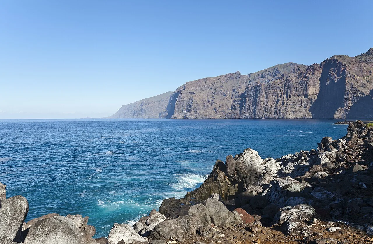
Diego Delso, Wikimedia Commons, CC BY-SA 3.0.
Los Gigantes Cliffs
How tall the Los Gigantes cliffs really are, the best free viewpoint, how to see them from the sea and when to go for the best photos, with official geological data.
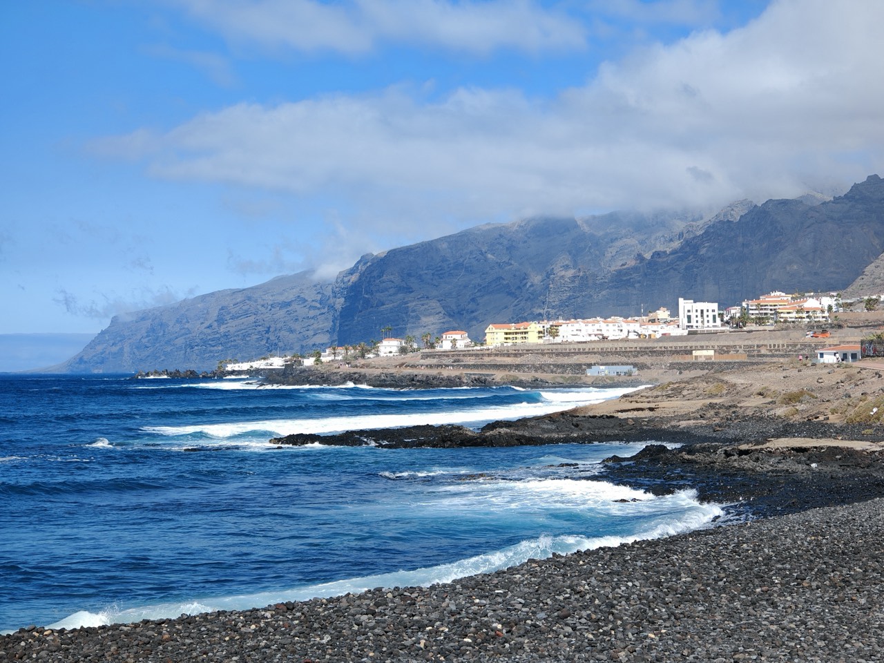
The Los Gigantes cliffs are the great postcard image of Tenerife's west coast: a volcanic wall dropping almost vertically into the Atlantic for several kilometres, between Puerto de Santiago and Punta de Teno. This page brings together what you need to know to understand and see them properly, checked on 15 September 2026.
How tall are they, and how did they form?
Height is one of the figures that varies most between sources, and it is worth being honest about that instead of repeating a single number. The Spanish Geological Heritage Inventory, which scientifically catalogues the active section (code IC4020), documents walls of between 200 and 500 metres. Most tourist guides mention up to 600 metres, and some sources put the figure as high as 800 metres at the highest points of the massif towards Punta de Teno. There is no single verified public measurement for the whole coastal front, but every source agrees this is one of the tallest sea cliffs in Spain.
Geologically, they are basaltic lava flows under one metre thick each, stacked by fissural volcanic activity between 4.5 and 5.5 million years ago, during the first building cycle of the Teno massif. The result is an almost vertical wall with visible columnar jointing in the upper sections, one of the best-preserved geological records on Tenerife.
Three ways to see them
There is no single correct way to visit them; each shows something different. A land viewpoint gives you the scale of the whole wall against the marina and coast. Playa de Los Guíos, at their feet, shows the near-vertical wall from below while you swim in calm water. And from the sea, by boat or kayak, is the only way to appreciate the full rock face falling straight into the water, which no viewpoint can reproduce.
Mirador de Archipenque, the most accessible view
The Mirador de Archipenque, in Puerto de Santiago, is the reference point for seeing the cliffs without booking any excursion: easy access, parking, information panels and a small café. From here you see the whole volcanic wall, the Los Gigantes marina and, on clear days, the silhouette of La Gomera and the Punta de Teno lighthouse. See also our best viewpoints in Los Gigantes comparison for more than one angle.
From the sea: beach and boat trips
Playa de Los Guíos, sheltered by the cliffs and the marina, is the simplest way to see them from below without booking anything: volcanic sand and calm water with direct views of the rock wall.
To see the full front from the water you need an excursion: a scenic boat, kayak or sailing boat, usually departing from Los Gigantes marina. Our Los Gigantes Blue guide compares prices, durations and ages for the main options.
When to go for the best photos
The cliffs face south-west, so afternoon light hits them head-on and brings out the texture of the rock: sunset is by far the most photographed moment. Early morning, with the sun still low, also gives good light and fewer crowds at the viewpoints. At midday, with the sun overhead, the contrast is flatter and the wall loses depth in photos. If you specifically want the sunset, check our best sunsets in Santiago del Teide guide.
Wildlife and protected land
The cliffs are part of the Teno Rural Park, one of the oldest natural areas on Tenerife. Their rock faces provide habitat for cliff-nesting raptors such as the Barbary falcon, the Canary subspecies of the peregrine falcon, and the common kestrel. But the most singular resident is the Tenerife giant lizard (Gallotia intermedia): thought extinct for decades, a group of naturalists rediscovered it in 1996 in precisely these cliffs, where one of only two known populations in the world now survives, with between 200 and 400 individuals according to the Cabildo de Tenerife. At sea, the depth reached very close to shore explains why this stretch of coast has one of the most stable year-round populations of short-finned pilot whales and common dolphins in the Canary Islands.
The Wall of Hell
Before being called Los Gigantes, the island's earlier inhabitants knew these cliffs as the Wall of Hell (Muralla del Infierno), for how imposing and impassable they looked from the sea. The current name, much more recent, refers to the scale of the rock wall facing the ocean. The town of Los Gigantes at its foot was not built until the 1960s.
Before you go
Access to the viewpoints and to Playa de Los Guíos is free. Parking is the usual weak point: check our Los Gigantes parking guide before heading down, especially at weekends or in high season. If you book a boat trip, confirm the sea-condition cancellation terms directly with the operator before paying.
Frequently asked questions
How tall are the Los Gigantes cliffs?
It depends on the source: the official geological inventory documents between 200 and 500 metres for the studied section, while tourist guides mention up to 600 or 800 metres at the highest points towards Punta de Teno. There is no single public measurement for the whole coastal front.
What is the best free viewpoint?
Mirador de Archipenque, in Puerto de Santiago: easy access, parking and full views of the wall, the marina and, on clear days, La Gomera.
Can you see them from the beach?
Yes. Playa de Los Guíos sits at their foot and lets you see them from below while swimming, in calm water sheltered by the cliffs and the marina.
Is a boat trip worth it?
If you want to see the full rock face falling into the water, yes: it is a perspective no land viewpoint can reproduce. Compare options in our Los Gigantes Blue guide.
When is the best time for photos?
At sunset, because the light hits the south-west-facing wall head-on. Early morning is the second-best option and has fewer people.
Last checked
2026-09-15
To make the most of your visit
- Confirm opening times, booking details and conditions on the same day if your plan depends on a provider.
- Check parking, sea conditions or weather before travelling.
- Combine this listing with area guides to avoid unnecessary journeys.